Frequently asked questions
Is there a free property boundary map for Australia?
Yes - MapMyLot is free for up to 5 property lookups per day with no account required. It covers all major Australian states including Queensland, New South Wales, Victoria, Tasmania and the ACT. You can see the official cadastral boundary, land area in m2 and hectares, and perimeter for any address. No lot number needed.
How do I find my property boundary lines online?
Type your street address into MapMyLot and your property boundary is shown on the map instantly. The boundary comes from official government cadastral records - the same data used by councils, conveyancers and real estate agents. You do not need to know your lot number, plan number or certificate of title.
How do I check if my fence is on the boundary?
Search your address in MapMyLot and zoom in on the boundary overlay. The cadastral boundary shows the legal lot line as recorded in the government title register. Switch to satellite view to compare the boundary line against your fence position. Note that cadastral data is accurate to approximately 1-2 metres - for a legally binding determination, engage a registered surveyor.
Can I check my neighbour's property boundary?
Yes. You can look up any property by address - not just your own. This is useful when checking a fence line, resolving a boundary dispute, or doing due diligence on a property you are considering buying. The data is sourced from public government cadastral records.
How do I find property boundaries in New Zealand?
MapMyLot covers all of New Zealand using data from Land Information New Zealand (LINZ), the official government cadastral register. Search any NZ address and the lot boundary, area and perimeter will appear instantly. The data includes residential, rural and Maori land parcels. No lot number or certificate of title number required.
How do I find property boundaries in England, Wales and Scotland?
MapMyLot covers England and Wales using HM Land Registry INSPIRE cadastral data, and Scotland using Registers of Scotland INSPIRE data - together covering the whole of the UK. Search any address and the registered title boundary appears on the map. INSPIRE boundaries are indicative general boundaries and should not be used as a substitute for a formal title plan.
How do I find property boundaries in British Columbia?
MapMyLot covers British Columbia using data from the BC Land Title and Survey Authority (LTSA) open data catalogue. Search any BC address to see the parcel boundary, area and perimeter. MapMyLot also covers Manitoba, New Brunswick and Yukon. Boundaries are displayed in both metric (m2, hectares) and imperial (acres) units.
Why use MapMyLot instead of the government mapping portals?
Government portals like QLD Globe, NSW Spatial Viewer, or LINZ Map Viewer require you to already know your lot number or plan reference, are desktop-only, and cover only one jurisdiction at a time. MapMyLot works from a plain street address, works on mobile, covers 11 regions in one tool, and gives you the area and perimeter measurement directly.
Is this a licensed survey?
No. MapMyLot displays cadastral boundary data sourced from government records for informational purposes only. It is not a licensed survey. For legally binding boundary determination, engage a registered surveyor.
How accurate are the boundaries?
Accuracy depends on the source jurisdiction's data. Government cadastral data is typically accurate to within 1-2 metres for most residential and rural lots. Historical lots and recently subdivided land may show outdated boundaries. Always verify with a registered surveyor for legal matters.
Can real estate agents use MapMyLot?
Yes - MapMyLot Pro is built for real estate agents and buyer's agents. The Pro plan gives you unlimited lookups, all seven Pro data layers (flood, bushfire, zoning, heritage, easements, electricity and coastal erosion, where mapped), unconstrained area, frontage, Search nearby, Compare properties, boundary segment lengths, and PDF boundary reports you can share with clients. At $19.99 AUD per month it costs less than a single title search.
What does the Pro plan include?
Pro ($19.99 AUD per month) includes unlimited lookups, the seven Pro data layers (Flood Zones, Bushfire, Zoning, Heritage, Easements, Electricity, Coastal Erosion, where mapped), unconstrained area, frontage, Search nearby, Compare properties, boundary segment lengths shown on the map, and PDF boundary reports you can share with clients. Saving properties is free with any account, not a Pro benefit. If you just need one report for a single property, buy a one-time PDF for $4.99 AUD - no subscription needed.
Can I check if a property is in a flood zone?
Yes, where flood data is mapped. MapMyLot's flood zone check is live for Victoria, the UK (England, Wales and Scotland) and New Brunswick, and sparse in Queensland (a small central slice only). It is not yet mapped for New South Wales, Tasmania, the ACT, New Zealand, British Columbia, Manitoba or Yukon. A missing reading for those areas means the data is not loaded, not that the property is clear of flood risk - see the flood zone guide for the full covered list.
What data layers can I see on a property?
MapMyLot shows nine data layers where mapped: Protected Areas and Agri Land are free; Flood Zones, Bushfire, Zoning, Heritage, Easements, Electricity and Coastal Erosion are Pro. Each layer has its own jurisdiction coverage - see the data layer coverage matrix on this page for exactly where each one is live.
What does MapMyLot check for free?
Every free search includes the official boundary, land area and perimeter, proximity readouts for coast, nearest park, waterway, water body, transmission line and flood zone, a constraint score, a suburb size percentile, and the Protected Areas and Agri Land data layers - up to 5 property lookups per day, no account required.
Where does the boundary data come from?
All boundary data is sourced from official government open-data portals: QLD Spatial (data.qld.gov.au), NSW DCCEEW (data.nsw.gov.au), LINZ (data.linz.govt.nz), BC Ministry of Crown Lands (data.bc.ca), HM Land Registry INSPIRE (use-land-property-data.service.gov.uk), and Registers of Scotland INSPIRE (ros.gov.uk). All datasets are released under open-data licences (CC BY, OGL or similar).
Can I cancel anytime?
Yes. You can cancel your Pro subscription at any time from your account panel. You keep Pro access until the end of your current billing period.
What is cadastral data?
Cadastral data is the official government record of land parcel boundaries, ownership, and area. Each jurisdiction maintains a cadastral register - in Australia this includes QLD Spatial, NSW Spatial Services, and state-level land registries. MapMyLot indexes cadastral boundary data from these official open-data sources and displays them on an interactive map.
Does MapMyLot work on mobile?
Yes. MapMyLot is fully mobile-responsive and works on iOS and Android browsers. You can search an address, view the boundary, and export a PDF report from your phone or tablet. No app download required.
Can I share or export the boundary data?
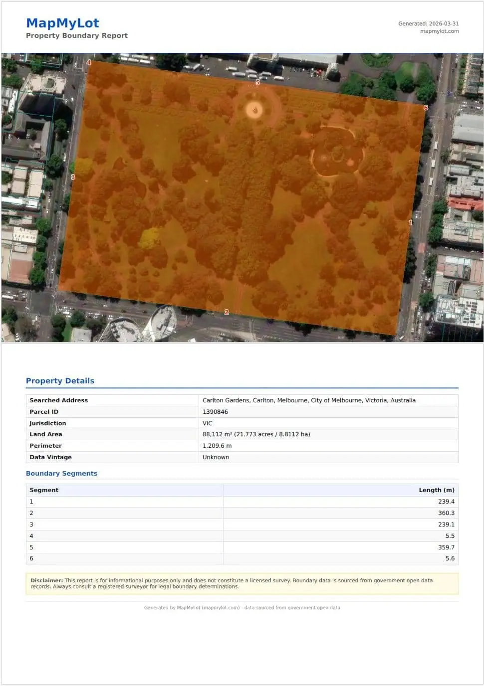
Pro subscribers can export a PDF boundary report that includes the map screenshot, land area, perimeter, segment lengths for each boundary line, and a page for every constraint found on the property - flood, bushfire, zoning, heritage, easements, electricity and coastal erosion, where mapped. The PDF can be shared with clients, solicitors, or used in due diligence reports. Raw GeoJSON or shapefile export is not currently available.
How current is the property boundary data?
Data is updated periodically from government open-data sources. For most jurisdictions, data is refreshed quarterly to annually. For recently subdivided lots or new developments, boundaries may not yet be reflected - check the relevant state or national cadastral portal for the most current data on new subdivisions.