How big is my block of land? Check the mapped area free
On this page
"How big is this block, really?" is the question that comes up the moment a subdivision, an extension, or a listing's claimed size starts to feel like it doesn't quite match what you're standing on. Search a street address on MapMyLot and the mapped block area appears in the readout panel in square metres, with a hectares conversion for larger blocks - calculated directly from the cadastral boundary polygon, not a satellite estimate or a rounded figure copied from a listing.
Check your block size now - free, no account needed
Check an address freeFive free address lookups a day, no account needed. Additional readouts depend on local data coverage.
Where the figure comes from
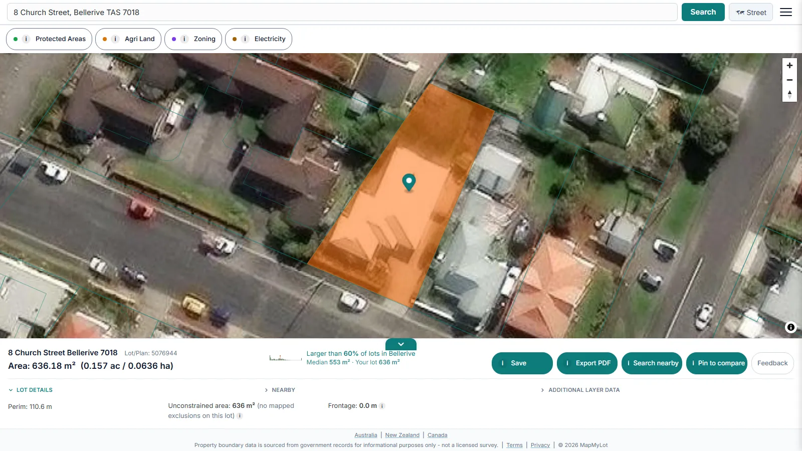
MapMyLot draws the boundary from the official government cadastral dataset for the property's jurisdiction (in Australia, coordinated nationally by ICSM, the intergovernmental cadastre coordination body) and calculates area from that boundary polygon directly. That is the same underlying data a title search or a surveyor would reference, so the figure should closely match what is recorded on the title.
Perimeter and the satellite view
Alongside area, the readout shows the perimeter in metres. Toggling the map to satellite view overlays the boundary on aerial imagery, useful for seeing how much of the block is actually cleared, built on, or usable - a block size figure alone does not show that.
Why the mapped figure matters
Block size drives what is realistically buildable on a block, whether a subdivision is worth investigating, and how a listing's claimed size compares to reality. Checking the cadastral figure directly, rather than trusting an ad, removes the guesswork before you inspect or make an offer.
Note: cadastral data is subject to positional variation by location and source dataset. For a figure that carries legal weight, confirm against the title document or a registered surveyor.
Free to check, Pro for unlimited
Five address lookups a day are free, with no account required - enough to check a handful of block sizes. MapMyLot Pro, at A$19.99 a month, removes the daily limit and adds unlimited PDF boundary reports, useful for agents or buyers comparing block sizes across several properties in one session. A single PDF report is also available for A$4.99 without a subscription.
A listing, rates notice, title and calculated map area can use different parcel definitions, rounding or source versions. Check that you are comparing the same parcel. The mapped polygon is a reference for investigation, not proof that another document is wrong.
Related checks
See how lot size is calculated across Australian states, or check whether a fence sits on the boundary.
Check a listing against the mapped block
Write down the advertised area and compare it with the mapped parcel. Confirm that the address refers to the same lot, that a listing has not combined several titles, and that a recent subdivision is reflected in both records. Ask the agent for the title or plan if the figures differ; a difference alone does not establish which figure is wrong.
For units and conversions across Australian states, see the Australian lot-size guide.
Check an address in three steps
- Open the map, enter the street address and select the matching result.
- Confirm the highlighted parcel is the one you meant to check, then read its area and perimeter.
- Use satellite view for visual context and review the available readouts. If the parcel or figures do not match your documents, investigate the difference before relying on them.
What to do after your first check
Confirm you have the right parcel, then compare its mapped size and shape with the listing or your documents. If you need a copy for your own research, a one-off PDF property report costs A$4.99. For repeated checks, Pro costs A$19.99/month and includes unlimited lookups and PDF reports. Compare the options after checking the address. Reports are informational and do not replace a survey or title search.
Check your block size now - free, no account needed
Check an address freeFive free address lookups a day, no account needed. Additional readouts depend on local data coverage.
Frequently asked questions
How do I check how big my block of land is?
Is this more accurate than a listing's stated block size?
What if I also need the perimeter or a satellite view?
Is my area included?
MapMyLot currently covers:
- Australia: Queensland, New South Wales, Victoria, Tasmania, and the ACT
- Canada: British Columbia, Manitoba, New Brunswick, and Yukon
- New Zealand
- UK: England, Wales, and Scotland
Search your address directly to confirm. An address outside these areas will not return a boundary, and MapMyLot will say so rather than showing a guess.