Is a fence on the boundary? Check property lines first
On this page
Compare the mapped parcel boundary with a visible fence on satellite imagery as a first visual check. If the two appear to differ, the cause could be the fence position, cadastral mapping accuracy or imagery alignment. MapMyLot cannot determine whether a fence is legally on the boundary; a licensed surveyor can establish the line on the ground.
Check a fence against the boundary now - free
Check an address freeFive free address lookups a day, no account needed. Additional readouts depend on local data coverage.
Why this matters before you act
A fence that has stood in the same place for years is not automatically on the true boundary - fences get built to a tradesperson's best guess, to an old (sometimes incorrect) marker, or simply where it was convenient, and small discrepancies of a metre or more are common on older properties. Confirming roughly where the real line sits before a conversation, a rebuild, or a dispute means you are arguing from the actual boundary, not a shared assumption that turns out to be wrong.
What the boundary check actually shows
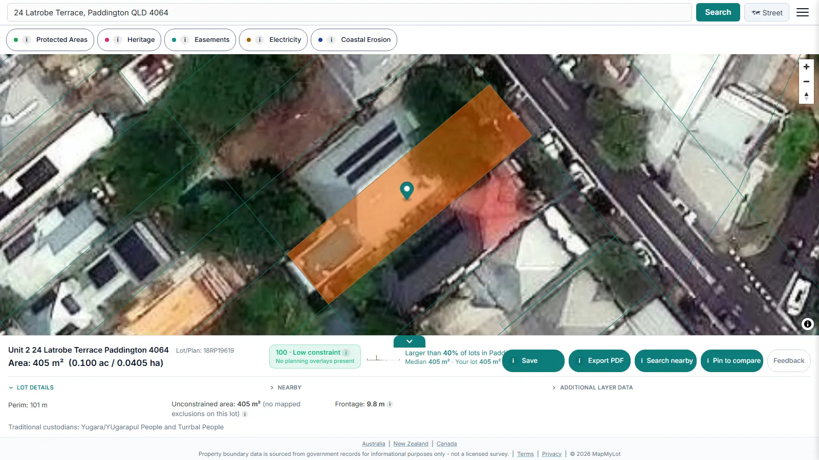
MapMyLot's readout shows the cadastral boundary polygon, sourced from the relevant government cadastral dataset for the property's jurisdiction (in Australia, coordinated by ICSM), plus land area and perimeter. The line is subject to positional variation by location and source dataset - enough to flag an obvious discrepancy, not enough to settle a contested boundary.
When you need more than a satellite check
If a fence looks materially off the cadastral line, or a neighbour disputes where it should sit, the next step is a formal boundary determination from a registered surveyor, not a DIY measurement or an argument built on a MapMyLot screenshot. Queensland residents can start with the state's fencing and neighbour disputes guidance for the legal process. The satellite check exists to tell you whether that step is worth taking, not to replace it.
Note: cadastral boundary data is subject to positional variation by location and source dataset and is not a substitute for a licensed survey. For a fence line dispute, engage a registered surveyor.
Free to check, Pro for unlimited
Five address lookups a day are free, with no account required - enough to check a fence on a handful of properties. MapMyLot Pro, at A$19.99 a month, removes the daily limit and adds unlimited PDF boundary reports, useful if you are checking several fences across multiple properties, or want a report to hand to a neighbour or a surveyor as a starting point. A single PDF report is also available for A$4.99 without a subscription.
Related checks
See how lot size is calculated, or check a property's proximity to power lines, flood zones, the coast, and parks.
Check a fence against the boundary now - free
Check an address freeFive free address lookups a day, no account needed. Additional readouts depend on local data coverage.
Frequently asked questions
Can MapMyLot tell me if a fence is exactly on the boundary?
What should I do if a fence looks clearly off the boundary?
Does this work for any Australian state?
Is my area included?
MapMyLot currently covers:
- Australia: Queensland, New South Wales, Victoria, Tasmania, and the ACT
- Canada: British Columbia, Manitoba, New Brunswick, and Yukon
- New Zealand
- UK: England, Wales, and Scotland
Search your address directly to confirm. An address outside these areas will not return a boundary, and MapMyLot will say so rather than showing a guess.