How to find your property boundary in NSW
On this page
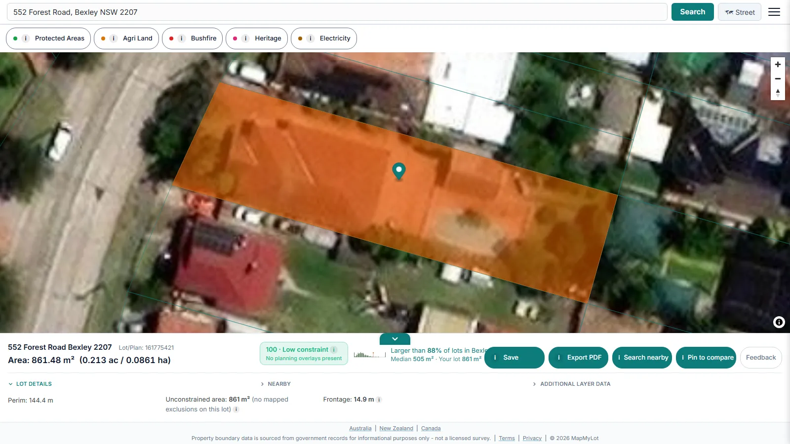
Find a mapped NSW property boundary by searching the street address on MapMyLot. The parcel outline, area and perimeter appear together, with proximity readings where data is available. Five daily lookups are free and no account or lot/DP number is needed. Use the map for an initial check, then confirm the title or survey if the legal boundary matters.
Find your NSW property boundary now - free, no account needed
Check an address freeFive free address lookups a day, no account needed. Additional readouts depend on local data coverage.
Lot and DP numbers versus a street address
NSW cadastral records, sourced from NSW Spatial Services, identify a parcel by lot and Deposited Plan number - for example 22//DP1211750 - not by street address alone. That reference appears on a Certificate of Title or a plan of subdivision, rarely on documents a homeowner has to hand day to day. MapMyLot resolves the street address to the matching parcel automatically, so the lot/DP reference is never something you need to look up first.
What you get from the search
Beyond the boundary polygon, the readout panel shows land area in square metres and hectares and perimeter in metres, plus - where the address falls inside covered proximity data - straight-line distance to the nearest high-voltage power line, mapped flood zone, the coast, and the nearest park. Every distance is measured from the parcel's full boundary, not a single centre point.
Note: cadastral boundary data is subject to positional variation by location and source dataset. For a legally binding determination - such as a fence line or setback dispute - engage a registered surveyor licensed in New South Wales.
Free to check, Pro for unlimited
Five address lookups a day are free, with no account required - enough to check a handful of New South Wales properties. MapMyLot Pro, at A$19.99 a month, removes the daily limit and adds unlimited PDF boundary reports, useful for agents, buyers comparing several properties, or anyone doing repeat lookups. A single PDF report is also available for A$4.99 without a subscription.
NSW cadastral data is refreshed on the state's own update schedule, so a recent subdivision may take time to appear. If a search returns no boundary for a brand-new lot, that generally means the subdivision has not yet been registered in the source dataset rather than an error in the search.
Related checks
See how lot size is measured across Australian states, check proximity to power lines, flood zones, the coast, and parks, or compare two NSW lots side by side on the comparison page.
Check an address in three steps
- Open the map, enter the street address and select the matching result.
- Confirm the highlighted parcel is the one you meant to check, then read its area and perimeter.
- Use satellite view for visual context and review the available readouts. If the parcel or figures do not match your documents, investigate the difference before relying on them.
What to do after your first check
Confirm you have the right parcel, then compare its mapped size and shape with the listing or your documents. If you need a copy for your own research, a one-off PDF property report costs A$4.99. For repeated checks, Pro costs A$19.99/month and includes unlimited lookups and PDF reports. Compare the options after checking the address. Reports are informational and do not replace a survey or title search.
Find your NSW property boundary now - free, no account needed
Check an address freeFive free address lookups a day, no account needed. Additional readouts depend on local data coverage.
Frequently asked questions
What data does MapMyLot use for NSW property boundaries?
Do I need my lot and DP number to search?
Can I use this for a fence line dispute in NSW?
Is my area included?
All 3.35 million cadastral parcels across New South Wales are covered. MapMyLot also covers:
- Rest of Australia: Queensland, Victoria, Tasmania, and the ACT
- New Zealand
- Canada: British Columbia, Manitoba, New Brunswick, and Yukon
- UK: England, Wales, and Scotland