Am I in a flood zone? Check mapped flood information
On this page
Where flood mapping is loaded, MapMyLot shows whether a parcel intersects a mapped flood zone and its distance to the nearest mapped zone within the display range. Coverage is strongest in Victoria, the UK and New Brunswick, with sparse Queensland data. For an address elsewhere, start with the relevant council or government flood map.
Check a property's flood zone distance
Check an address freeFlood distance is free where mapped; the flood overlay requires Pro. Coverage: VIC, UK, NB and sparse parts of QLD.
How the flood check works
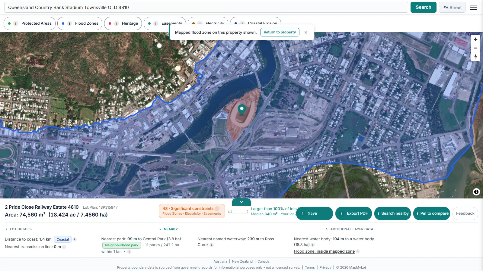
The check runs from the parcel's full boundary geometry, not a single point, to the nearest edge of a mapped flood zone polygon, capped at 5 kilometres so a distant, irrelevant match is never returned as if it meant something. A property that intersects a mapped zone is treated as inside it, at distance zero, rather than shown a small positive number that could wrongly read as a safety margin. Where flood mapping is loaded for an area, the reading appears the moment an address is searched - no separate report, no waiting.
What "inside a flood zone" means on MapMyLot
A distance of zero means the parcel clips or sits inside a mapped flood zone polygon - MapMyLot deliberately shows this as "inside" rather than a small positive number, because a figure like "12 metres" could wrongly read as a safety margin when the property already intersects the mapped area. Beyond 5 kilometres, MapMyLot stops returning a distance at all: an uncapped nearest-match could otherwise surface a flood zone many kilometres away and imply a connection to the property that does not exist. Neither reading is a certification. A flood zone boundary reflects the extent of a mapped study area, not a guarantee that everywhere inside it floods the same way, or that everywhere just outside it never will.
Related proximity checks
Flood zone distance is one of six proximity signals MapMyLot calculates automatically from the same address search. See the proximity overview, or check a property's distance to power lines, distance to the coast, distance to the nearest park, or distance to the nearest waterway.
Is your area mapped?
Flood zone data is not available everywhere MapMyLot works. Currently live where flood study data has been loaded:
- Victoria
- UK: England, Wales, and Scotland
- New Brunswick
- Queensland (sparse - roughly 20 mapped flood polygons statewide)
Not yet covered:
- New South Wales
- Tasmania
- The ACT
- New Zealand
- Canada: British Columbia, Manitoba, and Yukon
If a property sits outside the covered list above, MapMyLot has no flood data for that plot and shows nothing - and that absence is not a safety reading. It means the area has not been mapped yet, not that it is clear of flood risk. A council flood certificate is the authoritative source for a specific address. UK addresses can check the equivalent official service directly at GOV.UK's long-term flood risk checker, and Queensland's sparse coverage is confirmed by the Queensland Floodplain Assessment Overlay dataset itself.
If your address is outside the flood coverage list, MapMyLot still has something useful for that address: the exact boundary and lot area, the distance to the coast, the distance to power lines, and the distance to the nearest park or waterway - all free, on the same search.
Before you rely on it
A flood zone distance from MapMyLot is a starting point for research, never a substitute for a council flood certificate, a hydrology report, or insurance advice. Flood risk assessments that matter to a purchase, build, or insurance decision should always go through the relevant council or a qualified professional.
Check a property's flood zone distance
Check an address freeFlood distance is free where mapped; the flood overlay requires Pro. Coverage: VIC, UK, NB and sparse parts of QLD.
Frequently asked questions
If MapMyLot shows no flood reading, is the property flood-free?
What does it mean if the property intersects a flood zone?
Why is the distance capped at 5 kilometres?
Is my area included?
Flood zone distance is currently live in:
- Victoria
- UK: England, Wales, and Scotland
- New Brunswick
- Queensland (sparse - roughly 20 mapped flood polygons statewide)
Not yet covered:
- New South Wales
- Tasmania
- The ACT
- New Zealand
- Canada: British Columbia, Manitoba, and Yukon