How far is a property from the coast? Beachfront, beachside, and coastal distance explained
On this page
"Beachside" on a listing can mean anything from a genuine ocean view to a twenty-minute drive with the sea somewhere in the general direction. Search an address on MapMyLot and, where coastline data is available, the parcel readout shows the real straight-line distance from the property boundary to the coast, along with a tier: beachfront, beachside, or coastal - a number, not an adjective a copywriter chose. Tap the reading and the map highlights the actual stretch of coastline the distance was measured against.
Check a property's distance to the coast
Check an address freeFive free address lookups a day, no account needed. Additional readouts depend on local data coverage.
The three coastal tiers
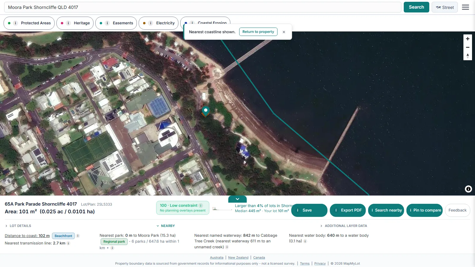
MapMyLot uses three distance bands: Beachfront is under 150 metres, Beachside is under 500 metres, and Coastal is under 2 kilometres. These are product labels based on straight-line distance to mapped coastline. They do not confirm a sandy beach, direct frontage, a sea view, public access or a particular walking time.
Straight line, not walking distance
Every coastal distance on MapMyLot is measured as the crow flies from the parcel boundary to the nearest coastline. It is not a walking route and does not account for roads, headlands, or river mouths that could make the real walk considerably longer than the straight-line number suggests. Treat the tier and the distance as a starting point, and check the actual walking route yourself for anything more than a rough sense of access.
Coverage
Coastal distance is currently live where coastline data has been loaded, sourced from Geoscience Australia for the Australian coastline and from OpenStreetMap contributors elsewhere:
- Australia: Queensland, New South Wales, Victoria, Tasmania, and the ACT
- New Zealand
- UK: England, Wales, and Scotland
- Canada: British Columbia
Not yet covered:
- Canada: Manitoba, New Brunswick, and Yukon
An absent reading can mean no coastline match was returned within the search range, or that data is unavailable for that location, not that the property is confirmed inland - it never means "safe" or "far", only "no data yet".
Related proximity checks
Coastal distance is one of six proximity signals MapMyLot calculates automatically from a single address search. See the proximity overview, check a property's distance to the nearest park, or its distance to the nearest waterway.
Coastal proximity also tends to carry a price premium that varies a lot by market, so a precise, tier-labelled distance is useful well beyond lifestyle - it is a starting point for comparing two otherwise similar listings that both claim to be near the water, before you compare them in person or against recent sales.
Check a property's distance to the coast
Check an address freeFive free address lookups a day, no account needed. Additional readouts depend on local data coverage.
Frequently asked questions
What counts as beachfront on MapMyLot?
Is the distance a walk time or a straight line?
What if a property is more than 2 kilometres from the coast?
Is my area included?
Coastal distance is currently live in:
- Australia: Queensland, New South Wales, Victoria, Tasmania, and the ACT
- New Zealand
- UK: England, Wales, and Scotland
- Canada: British Columbia
Not yet covered:
- Canada: Manitoba, New Brunswick, and Yukon
If your property is in an area without coastline data loaded yet, MapMyLot will not show a distance rather than guessing at one.