Bushfire prone land map: check coverage before searching
On this page
MapMyLot Pro can show mapped bushfire-prone land in covered parts of NSW, Victoria and the ACT. Search the address and open the Bushfire layer to see the mapped designation alongside the parcel. For a free official check or an address outside this coverage, use your state fire authority or planning map.
Check a property against the bushfire-prone land map
Open the bushfire checkBushfire overlays require Pro. Coverage: mapped parts of NSW, Victoria and the ACT. No BAL rating is calculated.
How the bushfire-prone land check works
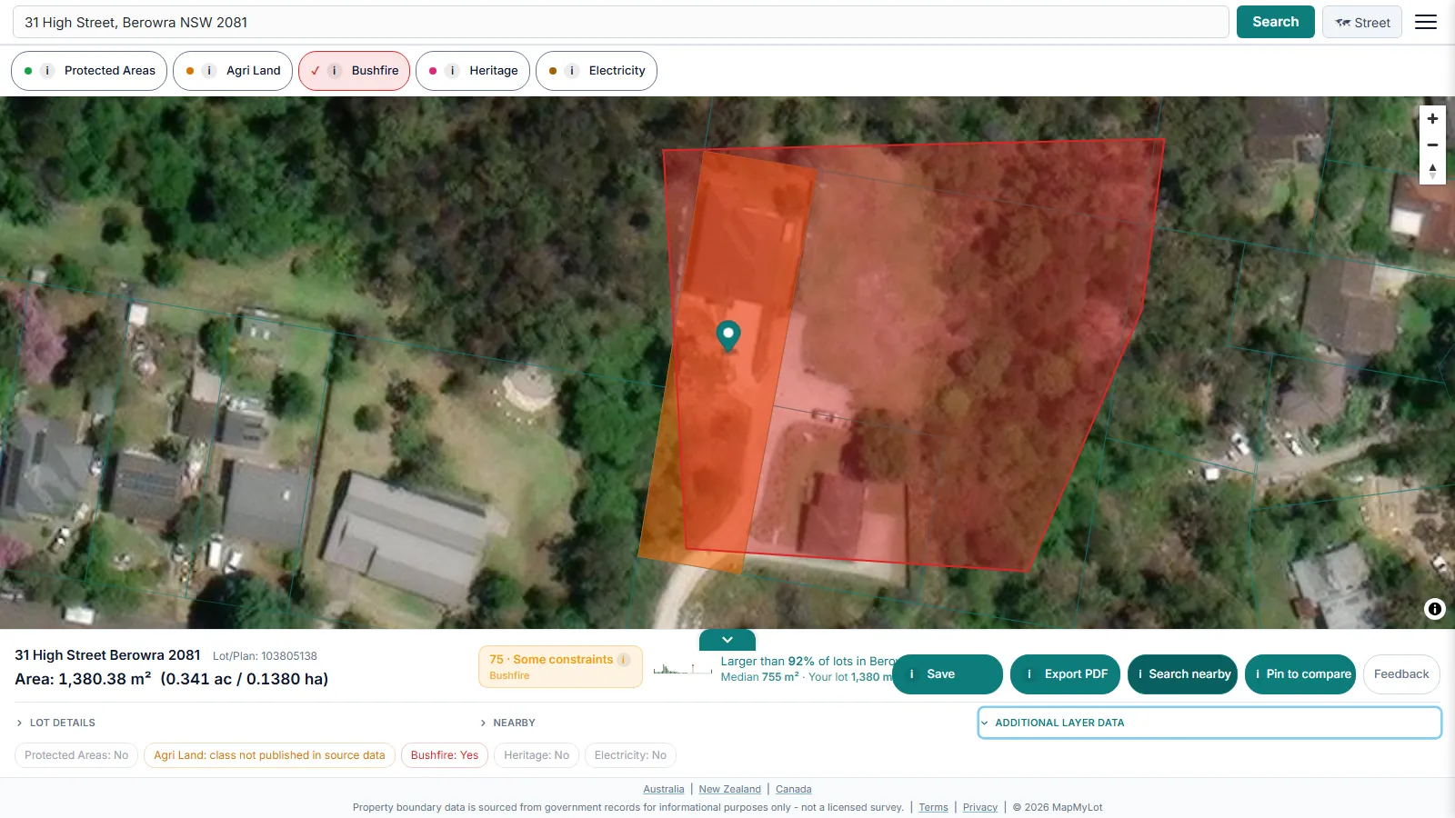
Search the address, then tap the Bushfire layer pill. Where the parcel intersects a mapped bushfire-prone area - like the rural New South Wales property shown above - MapMyLot draws the designated zone on the map, so you can see how far the boundary sits inside it, not just a single yes/no flag.
What the readout shows

Tapping the Bushfire pill adds a bushfire indicator to the property readout alongside boundary, lot size, and proximity data - all from the same address search.
Bushfire-prone land is a hazard designation, not a safety score
A bushfire-prone area (BPA) designation reflects mapped vegetation, terrain, and fire-history factors that state fire authorities use to identify heightened bushfire risk - it is a hazard flag, reported as-is, never a pass/fail safety rating. Being inside a mapped zone does not mean a property is unsafe to live in; being outside one does not mean it is risk-free, particularly given the coverage gaps described below. Treat the designation as one input into a broader risk picture, alongside local fire authority advice.
What the designation triggers for building
Building on designated bushfire-prone land may require a Bushfire Attack Level (BAL) assessment, depending on the jurisdiction and proposed work, which in turn sets requirements for non-combustible cladding, ember-proof vents and window shutters, and other construction standards - all of which can add significant cost to a build. See the Bushfire Attack Level guide for how that assessment works and what MapMyLot does and doesn't show about it.
Is my area covered?
MapMyLot's bushfire layer is currently live in:
- New South Wales (misses far-western NSW - the loaded dataset does not yet extend to the far west of the state)
- Victoria
- The ACT
Not yet covered:
- Queensland
- Tasmania
- New Zealand
- Canada: British Columbia, Manitoba, New Brunswick, and Yukon
If a property sits outside the covered area, or in far-western NSW, MapMyLot has no bushfire reading for it and that is a coverage gap, not a safety signal - always check with the relevant state or territory fire authority for an authoritative bushfire-prone determination. Addresses within cadastral coverage can still show their mapped boundary and lot area and a free proximity check against nearby parks, water, and powerlines. For flood risk specifically, see the flood zone guide - a different hazard layer with its own coverage.
Before you rely on it
A bushfire-prone reading from MapMyLot is a starting point for research, not a certificate. Before a purchase, build, or insurance decision, confirm bushfire-prone status directly with the relevant state or territory planning portal or fire authority, and engage an accredited assessor if a Bushfire Attack Level rating is required.
Check a property against the bushfire-prone land map
Open the bushfire checkBushfire overlays require Pro. Coverage: mapped parts of NSW, Victoria and the ACT. No BAL rating is calculated.
Frequently asked questions
Is my area covered?
MapMyLot's bushfire layer is currently live in:
- New South Wales (misses far-western NSW - see below)
- Victoria
- The ACT
Not yet covered:
- Queensland
- Tasmania
- New Zealand
- Canada: British Columbia, Manitoba, New Brunswick, and Yukon