Bushfire Attack Level (BAL): what it means for a build
On this page
A Bushfire Attack Level (BAL) describes a building's potential exposure to ember attack, radiant heat and direct flame contact. It can affect construction requirements and cost. A bushfire-prone land map is a useful first check, but it does not calculate a BAL rating; assessment requirements depend on the jurisdiction and proposed work.
Check if a property is in a bushfire-prone area
Open the bushfire checkBushfire overlays require Pro in covered parts of NSW, Victoria and the ACT. Use your state authority for a free official map.
What a BAL rating measures
Bushfire Attack Level is a construction standard defined in AS 3959, measuring a building's expected exposure to ember attack, radiant heat, and direct flame contact in a bushfire. Ratings run from BAL-LOW (negligible risk) through BAL-12.5, BAL-19, BAL-29, BAL-40, up to BAL-FZ (Flame Zone, the most severe exposure). Each step up the scale requires more stringent - and more expensive - construction detailing.
Check whether a property is in a bushfire-prone area
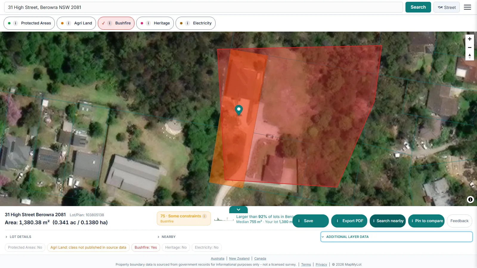
Check the relevant state or territory fire authority or planning map for an official bushfire-prone designation. MapMyLot Pro also displays this layer in covered parts of NSW, Victoria and the ACT. Neither map provides a site-specific BAL rating or, by itself, determines every assessment requirement.
What MapMyLot does and doesn't show
To be direct about the limit here: MapMyLot shows bushfire-prone area status, which may trigger further assessment - it does not calculate or display an actual BAL rating. The real rating depends on site-specific factors an accredited assessor measures on the ground: vegetation type and density, slope direction and gradient, and distance from the building to the classified vegetation. Two properties both flagged as bushfire-prone can end up with very different BAL ratings once assessed.
What drives the construction cost
Higher BAL bands require non-combustible or fire-resistant external cladding, ember-proof roof and wall vents, toughened glass or bushfire shutters on windows, and enclosed, ember-proof sub-floor spaces - construction detailing that adds meaningfully to material and labour cost as the rating climbs. BAL-40 and BAL-FZ sit at the top of that cost curve. Because the rating is site-specific, a quote based only on "the property is bushfire-prone" without a confirmed BAL number is only a rough guide.
Getting an assessment
Ask your council or building certifier which assessment is required and who can prepare it for your project. A qualified bushfire professional can assess the site and document the applicable construction requirements. MapMyLot's bushfire overlay is a Pro feature and provides mapped context only.
Related reading
For the bushfire-prone land map itself, coverage, and the hazard-vs-safety distinction, see the bushfire prone land map guide. Bushfire is one of several hazard and constraint layers MapMyLot checks automatically - see also the flood zone guide and the property's mapped boundary and lot area.
Start with the official requirements
For a Victorian project, see the government guide to building in designated bushfire-prone areas. For other states and territories, use the relevant planning or fire authority guidance.
Check if a property is in a bushfire-prone area
Open the bushfire checkBushfire overlays require Pro in covered parts of NSW, Victoria and the ACT. Use your state authority for a free official map.