New South Wales heritage register: mapped and official checks
On this page
Use the official State Heritage Register to confirm a state heritage listing, and check local council records separately. MapMyLot Pro displays mapped New South Wales heritage listings alongside the parcel boundary, helping you see their location and other available property information in one place.
Check a NSW address against the heritage register
Check a NSW propertyThe mapped heritage layer requires Pro. Check the official register and local council records for a complete enquiry.
How to check a NSW address against the heritage register
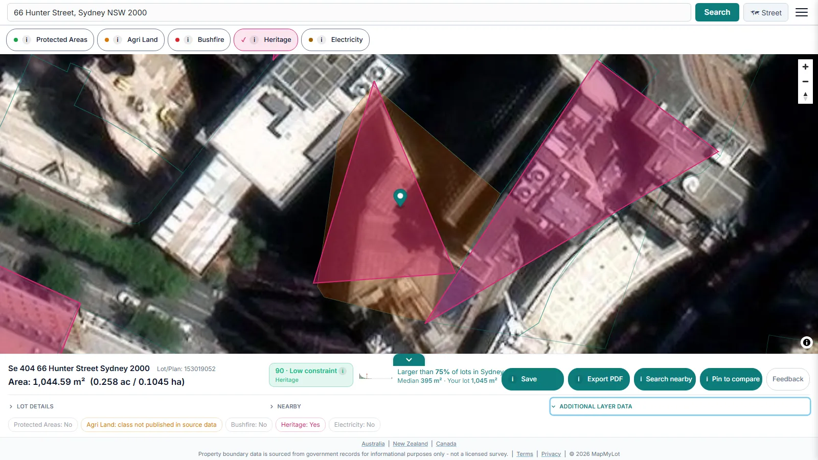
Search the address, then tap the Heritage layer pill. If the parcel intersects a State Heritage Register listing, MapMyLot draws the listed boundary on the map so you can see exactly what area or building the listing covers, rather than just a point marker in the right suburb.
What the readout shows

Tapping the Heritage pill adds a heritage indicator to the property readout alongside the property's boundary, lot size, and proximity data - all from the same address search.
What a State Heritage Register listing means
The State Heritage Register is maintained by Heritage NSW under the Heritage Act 1977 and covers places of state-level significance - a different, generally stricter tier than a local council heritage schedule, which covers items of local significance only. A state listing typically requires Heritage NSW or council approval for demolition, structural change, or additions, and can extend to controls on subdivision and significant trees on the site. Because the specific conditions vary by listing, the register entry for that individual place is the authoritative source, not a general rule of thumb.
Complementing the official register
Heritage NSW's own State Heritage Inventory search is the legally authoritative source and the place to confirm a listing before any decision that depends on it. MapMyLot's value is speed: the same address search that shows heritage status also returns the property's mapped boundary and lot area and its distance to nearby parks, water, and powerlines - a fuller picture in one search rather than several separate lookups.
Heritage overlay elsewhere
Looking for the general heritage-listing question across every covered state, or the Victorian "heritage overlay" planning-scheme term specifically? See the heritage-listing pillar guide and the heritage overlay guide.
Is my area covered?
MapMyLot's heritage layer is live across all of New South Wales, alongside Queensland, Victoria, the ACT, and the UK (England only). It is not yet loaded for Tasmania, New Zealand, or Canada. If an address sits outside NSW, see the heritage-listing pillar guide for the full coverage list.
Check a NSW address against the heritage register
Check a NSW propertyThe mapped heritage layer requires Pro. Check the official register and local council records for a complete enquiry.