Looking for a Nearmap free alternative? Here's what to use instead
On this page
If you need a satellite view with property lines, a free MapMyLot address check may cover the task. Nearmap's aerial imagery serves a different need: its capture programme, imagery options and commercial plans should be checked directly with Nearmap. Choose by the imagery and property information you need, not just the subscription price.
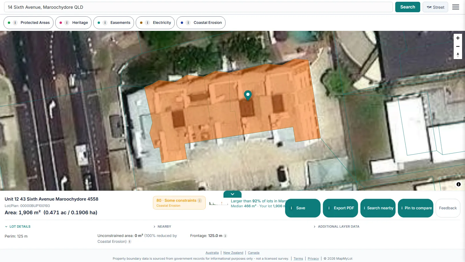
Get a satellite view with the property boundary on MapMyLot - free
Check an address freeFive free address lookups a day, no account needed. Additional readouts depend on local data coverage.
Free options that cover most of what people want
Google Maps and Google Earth are free and give a satellite view of almost any address, though the imagery's capture date varies by location and is not always recent. For Victorian government context specifically, MapshareVic is a free state viewer with property, forest, public land, and water themes. And for the boundary itself, not just an aerial photo, MapMyLot shows the official cadastral parcel outline over a satellite basemap, with area and perimeter in the readout, from a plain street address search - 5 lookups a day free, no account needed.
Where MapMyLot is not a Nearmap substitute
MapMyLot uses a satellite basemap rather than capturing its own aerial photography, and it does not provide oblique imagery. If your work needs recent aerial captures, specific image dates or specialist imagery products, compare Nearmap's current offering directly. A free boundary lookup is useful for parcel context, not a substitute for those imagery requirements.
What a free MapMyLot lookup actually returns
For the property questions behind most "nearmap free" searches, one free address lookup returns the official boundary over satellite view with area, perimeter, frontage and lot/plan, a lot-size benchmark against the suburb, a 0-100 constraint score, measured distances to powerlines, parks, the coast and waterways, and the free Protected Areas and agricultural land layers. Pro adds Zoning, Heritage, Easements, Flood Zones, Bushfire, Electricity transmission and Coastal Erosion layers on the same map.
Free to check, Pro for unlimited
Five address lookups a day are free on MapMyLot, no account required. MapMyLot Pro, at A$19.99 a month, removes the daily limit and adds unlimited PDF boundary reports. A single PDF report is also available for A$4.99 without a subscription.
Related checks
See free satellite maps with property lines for more free imagery sources, or compare MapMyLot against a paid competitor on the Landchecker comparison page. For everything a MapMyLot search returns, see the full feature overview.
Get a satellite view with the property boundary on MapMyLot - free
Check an address freeFive free address lookups a day, no account needed. Additional readouts depend on local data coverage.