LASSI map Victoria: what the modernised 4-in-1 platform does
On this page
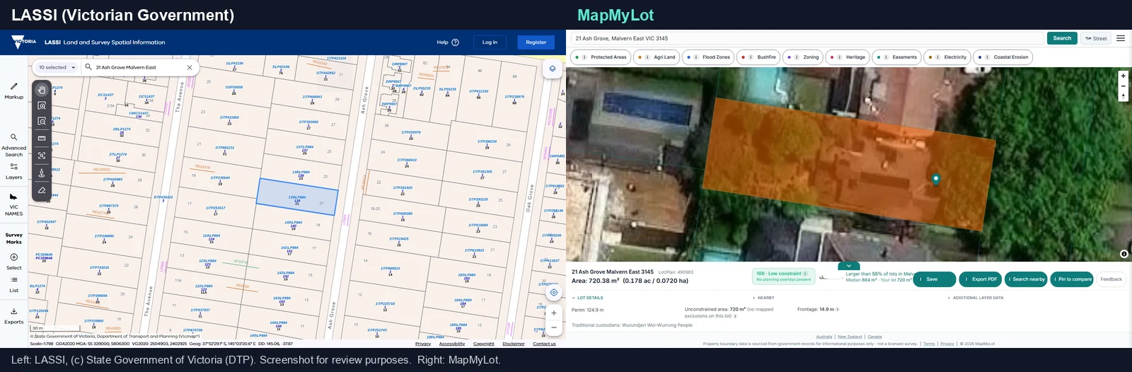
LASSI is Victoria's free Land and Survey Spatial Information service. Open the official LASSI map and choose Property Enquiry for land and parcel searches. The modernised service also includes survey mark and place-name enquiries. If you want a parcel boundary with available property readouts, you can also check an address on MapMyLot.
Search a Victorian address on MapMyLot - free, no account needed
Check an address freeFive free address lookups a day, no account needed. Additional readouts depend on local data coverage.
What changed in the 2026 relaunch
Before the relaunch, LASSI, LASSI-SPEAR, SMES, and VICNAMES were separate mapping services with separate interfaces. The modernised platform brings all four together behind one login-free landing screen: choose Property Enquiry (LASSI and LASSI-SPEAR combined) to search land and property information, Survey Mark Enquiry (SMES) to find or update survey mark data, or VICNAMES Enquiry to search the official Register of Geographic Names. The core functions are the same as before - what changed is a single, consistent, mobile-friendly experience across desktop, tablet, and phone, running on a modern cloud-based system.
What you can do with LASSI
Property Enquiry searches and exports land and property information, including Crown and freehold parcels. Survey Mark Enquiry finds the official register of survey marks and lets registered users submit updates, including from the field on a tablet or phone. VICNAMES Enquiry searches Victoria's official Register of Geographic Names and lets the public contribute historical information. Map tools across all three enquiry types include selecting features, measuring distance and area, annotating, and exporting as PDF, image, or CSV.
LASSI versus a plain address search
LASSI is the right tool when you need survey marks, a survey plan, or a place-name lookup - that data does not exist on MapMyLot. But for the much more common question of "what is this property's boundary, area, and perimeter," MapMyLot resolves a plain street address straight to the answer, with no enquiry-type selection first. MapMyLot also covers more ground than LASSI, which is Victoria only - the rest of Australia (QLD, NSW, TAS, ACT), New Zealand, British Columbia, Manitoba, New Brunswick, Yukon, and England, Wales, and Scotland are all on MapMyLot too.
LASSI shows the parcel fabric. MapMyLot reads the whole lot
LASSI provides parcel and survey information for different enquiry types. A free MapMyLot search on the same address returns the boundary plus everything a buyer or builder asks next:
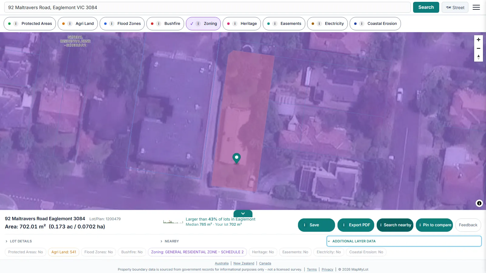
- The lot itself: the official cadastral boundary over satellite or street view, with area, perimeter, frontage and lot/plan number in one readout.
- How it compares: a lot-size benchmark against the suburb, so you know whether the block is larger or smaller than its neighbours.
- The constraint score: a 0-100 at-a-glance rating of how constrained the lot is by mapped planning layers, with the unconstrained area calculated for you.
- Proximity checks: measured distances from the lot to powerlines, the nearest park, the coast, waterways and other water bodies.
- Two data layers: Protected Areas (every MapMyLot jurisdiction) and agricultural land classification.
MapMyLot Pro adds seven more layers on the same map: Zoning (the planning zone applying to the lot), Heritage (mapped listings; local overlays need a separate check), Easements (registered easements crossing the parcel), Flood Zones, Bushfire, Electricity (transmission lines and easements) and Coastal Erosion. Hazard layers are reported as present or absent rather than averaged into a reassuring rating.
Note: LASSI's property and survey data is provided for reference and enquiry. For a legally binding boundary determination - a fence line dispute or a setback confirmation - engage a registered surveyor licensed in Victoria.
Free to check, Pro for unlimited
Five address lookups a day are free on MapMyLot, no account required. MapMyLot Pro, at A$19.99 a month, removes the daily limit and adds unlimited PDF boundary reports. A single PDF report is also available for A$4.99 without a subscription.
Related checks
See the MapshareVic guide for the broader property and land-feature viewer, what Vicmap actually is as the data behind LASSI's parcel search, or how to find a Victorian property boundary on MapMyLot. For the fundamentals in any state, start with how to find property boundaries.
Search a Victorian address on MapMyLot - free, no account needed
Check an address freeFive free address lookups a day, no account needed. Additional readouts depend on local data coverage.