How to find your lot number in Australia
On this page
Somewhere on a stack of paperwork is a string like "Lot 5 on RP812345" - the reference a title search, a building application, or a conveyancer will eventually ask for. Most owners have never memorised it and cannot produce it on demand. A lot number identifies a parcel in a state's official land title and cadastral records - for example, Lot 5 on RP812345 in Queensland, or a lot and Deposited Plan (DP) reference in New South Wales. It is not the same as a street number, and that gap between the two is where most of the confusion starts.
Check a boundary without needing the lot number - free
Check an address freeFive free address lookups a day, no account needed. Additional readouts depend on local data coverage.
Where to find your lot number
The lot number appears on your Certificate of Title, the original plan of subdivision or Deposited/Registered Plan for the property, and in some states on a rates notice or a council planning certificate. If you have any of those documents, the reference is printed on them directly - there is no need to search a government portal from scratch.
Checking the boundary without it
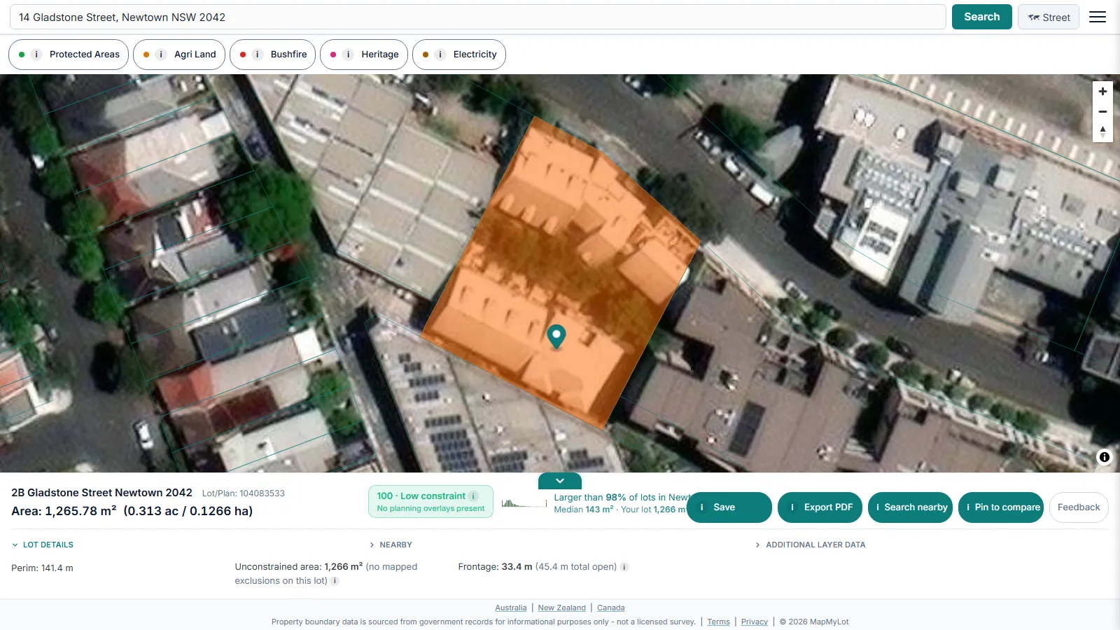
MapMyLot does not require a lot number at all. Search the street address on MapMyLot and the matching cadastral parcel resolves automatically, showing the boundary polygon, land area, and perimeter - useful when you want to confirm a boundary or lot size quickly and do not have a title document to hand.
When you do need the lot number
A lot number is still required for formal transactions - a title search, a building or development application, or a conveyancing matter - because it is the legal identifier land registries use, not the street address. For those, retrieve it from the title or planning certificate rather than guessing from a map.
Note: cadastral boundary data is subject to positional variation by location and source dataset and is sourced from government records - see ICSM, the intergovernmental cadastre coordination body for background on the national cadastral program - for informational purposes - not a substitute for an official title search.
Free to check the boundary
Five address lookups a day are free on MapMyLot, with no account required - enough to confirm a boundary and lot size for a handful of properties without a lot number. MapMyLot Pro, at A$19.99 a month, removes the daily limit and adds unlimited PDF boundary reports for anyone doing repeat lookups.
Formatting conventions vary by state:
- Queensland: Lot [number] on [plan prefix][number], for example RP or SP plans
- New South Wales: a lot//DP format, such as 22//DP1211750
Both identify the same kind of thing: the registered parcel reference behind a property's street address.
Related checks
See how lot size is calculated, or check whether a fence sits on the boundary.
Check a boundary without needing the lot number - free
Check an address freeFive free address lookups a day, no account needed. Additional readouts depend on local data coverage.
Frequently asked questions
Where does a lot number appear?
Do I need my lot number to use MapMyLot?
Is the lot number the same as a street number?
Is my area included?
MapMyLot currently covers:
- Australia: Queensland, New South Wales, Victoria, Tasmania, and the ACT
- Canada: British Columbia, Manitoba, New Brunswick, and Yukon
- New Zealand
- UK: England, Wales, and Scotland
Search your address directly to confirm. An address outside these areas will not return a boundary, and MapMyLot will say so rather than showing a guess.