How to read a New Zealand satellite boundary overlay
On this page
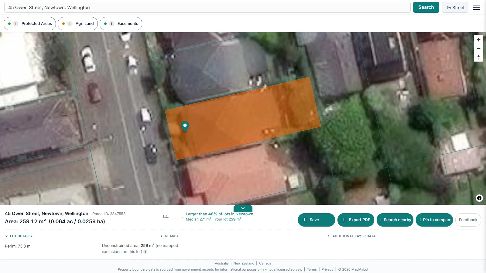
A satellite boundary overlay helps you compare a mapped LINZ parcel with visible fences, driveways and buildings. It cannot tell you whether a fence is legally in the right place. Start with the New Zealand property boundary lookup, then use this guide to interpret what the imagery and boundary line can show.
View a New Zealand property boundary map now - free, no account needed
Check an address freeFive free address lookups a day, no account needed. Additional readouts depend on local data coverage.
Street map or satellite - your choice
The map view supports both a standard street layer and satellite imagery. Switching to satellite is the more useful view for checking a boundary against a fence, a driveway, a shed, or where a hedge actually sits relative to the legal line - a street map alone cannot show that.
Where the boundary data comes from
The cadastral boundary is sourced from LINZ (Land Information New Zealand), the government agency responsible for New Zealand's official parcel records, covering 4.26 million parcels nationwide. MapMyLot draws the boundary as recorded, reprojected for display on the map.
Beyond the boundary line
The readout panel alongside the map also shows land area in square metres and hectares, perimeter in metres, and - where covered - straight-line distance to the coast, nearby parks and waterways.
Note: the cadastral line is subject to positional variation by location and source dataset and satellite imagery has its own alignment tolerance. For a boundary determination that matters legally, engage a licensed cadastral surveyor.
Free to check, Pro for unlimited
Five address lookups a day are free, with no account required, each with the full satellite/street map toggle included. MapMyLot Pro, at A$19.99 a month, removes the daily limit and adds unlimited PDF boundary reports for agents, buyers comparing several properties, or anyone doing repeat lookups. A single PDF report is also available for A$4.99 without a subscription.
Satellite imagery and cadastral boundary data update on separate schedules - the boundary line reflects LINZ's cadastral register, while the imagery underneath comes from the map provider and may be months or years old in a given area, particularly outside major urban centres.
Related checks
See the full New Zealand property boundary lookup guide, or check proximity to power lines, flood zones, the coast, and parks.
How accurate is the LINZ boundary overlay?
LINZ explains that digital cadastral accuracy varies by location and how the parcel was mapped. There is no universal 1-2 metre accuracy guarantee. Satellite alignment adds another source of variation. Use the overlay to identify and compare parcels; use a licensed cadastral surveyor to establish a boundary on the ground.
View a New Zealand property boundary map now - free, no account needed
Check an address freeFive free address lookups a day, no account needed. Additional readouts depend on local data coverage.
Frequently asked questions
Can I see a property boundary on a satellite map in New Zealand?
Is the boundary line exact on the satellite image?
Do I need to know my legal description to view the map?
Is my area included?
All 4.26 million cadastral parcels across New Zealand are covered, sourced from LINZ. MapMyLot also covers:
- Australia: Queensland, New South Wales, Victoria, Tasmania, and the ACT
- Canada: British Columbia, Manitoba, New Brunswick, and Yukon
- UK: England, Wales, and Scotland